
Top Trails
Writer Shannon Severson
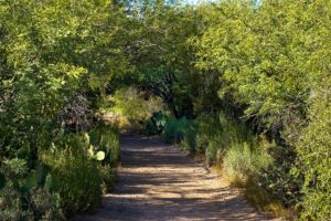
Whether it be on foot, wheels or horseback, following a scenic path through desert flora under a brilliant, sunny winter sky is one of the great joys of living in Arizona. There are hundreds of trails to choose from, allowing you to enjoy adventure and beautiful views within a short drive of wherever you live.
As we celebrate the great outdoors this month, Images Arizona has assembled a helpful starting guide to top trails for multiple ability levels — including locations where bicycles, horses and pets are welcome.
For this feature, we considered three of the Valley’s most popular trail hotspots: Papago Park, Spur Cross Ranch Conservation Area and the Sonoran Preserve. However, there is an abundance of other areas that also offer opportunities for hikers, bicyclists and horseback riders — including South Mountain Park and Preserve, McDowell Sonoran Preserve, White Tank Mountain Regional Park, Camelback Mountain and Dreamy Draw Recreation Area.

Easy-Going
According to the city of Phoenix’s Trails Rating Guide, hikes rated “easiest” have minimal elevation changes and accessible, paved, hard footing without any obstacles. Those rated “easy” have slight elevation change over minimally uneven footing with obstacles of 2 inches or less and some rocks or ruts may be encountered.
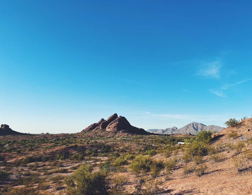
The majority of trails at Papago Park are easy for hikers, including the 2.3-mile Double Butte Loop Trail on the west side, which circles both the small butte immediately adjacent to the parking lot and the larger double buttes. Little Butte Loop branches off and affords beautiful views of downtown and Papago Golf Course and also boasts access to a small sandstone butte for exploration.
Papago Park’s 5k Fitness Loop, with its crushed granite trail, has exercise stations, shade ramadas and drinking fountains along its 3.1 miles. Meanwhile, Hole in the Rock features a very short dirt path leading to the park’s most recognizable geological feature: a hole in the dramatic butte caused by wind erosion. Extend the hike by veering off on the 1.4-mile Crosscut Canal Path, which winds past the Phoenix Zoo and Desert Botanical Garden.
For cyclists, Papago Park is considered ideal for beginners. Galvin Bikeway Trail is a 1.4-mile trail that connects Desert Botanical Garden, Papago Park and the Phoenix Zoo. It’s a concrete path so it’s fit for standard road bicycles as well as mountain bikes. Big Butte Loop, Chad’s Mom, Vigilante, Papago South and Double Butte Loop East are also highly recommended.
Of the nine trails spanning 7 miles at Spur Cross Ranch Conservation Area, the easiest is the .8-mile Metate-Towhee Loop, which is exclusively for hikers. Horses and cyclists can join hikers on the .6-mile Fairy Duster Loop and .2-mile Mariposa Hill.
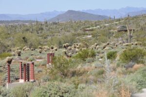
At the Sonoran Preserve, horses are allowed on all trails unless otherwise marked. Apache Wash Loop is an easy, 5.6-mile trail accessible from Apache Wash Trailhead, which is the only access with trails rated “easy” for both hikes and bikes. Mountains, trees, cactus, wildflowers in the spring and plenty of native wildlife can be seen and the elevation change is 200 feet over its course.
Also accessible from this trail is Badger Brawl Trail, which is highly recommended for cyclists and extends a distance of 3.4 miles. From there, you may want to connect with the 2.9-mile Cliff Walk Trail which follows alongside Cave Creek’s riverbed with beautiful views. You can also access the 3.4-mile Esplanade Trail from here.
For families, road cyclists and joggers who need a smooth surface and minimal incline, the Sonoran Preserve’s 1.9-mile East Skip Rimsza Paseo is fully paved and mostly runs along Sonoran Desert Drive. Meanwhile, the Desert Vista Trailhead has just one easy-rated hike — the 1-mile Bobcat Trail that is mostly flat, but gradually makes its way uphill towards the more difficult Dixie Mountain Loop.
The Middle Way
Trails with a “moderate” rating have more significant elevation changes over areas of uneven surfaces. Obstacles of 8 inches or less, along with rocks and ruts, are present. Those trails rated “moderate/difficult” have mostly uneven footing throughout the elevation changes with obstacles up to 12 inches and include loose rocks, ruts and even possible drop-offs.
At Papago Park, intermediate-level cyclists should check out the iconic Hole in the Rock and Loma trails. Hikers looking for a moderate challenge can try the Loma Trail, which includes a 63-foot climb.
At Spur Cross Ranch Conservation Area, the 2.6-mile Dragonfly Loop — part of the Jewel of the Creek Preserve operated by Desert Foothills Land Trust — is exclusively for hikers. The Tortuga Trail is the only moderate trail that allows horses alongside hikers, but not cyclists. Meanwhile, cyclists can ride along with horses and hikers on the 5.2-mile Spur Cross Trail, which reaches an elevation of 485 feet above sea level.
The lone intermediate-level hike accessible from the Sonoran Preserve’s Apache Wash Trailhead is the 1.5-mile Ridgeback Trail and its offshoot, the Ridgeback Overlook Trail, which takes you to the top of the hill for a 50-foot climb that rewards you with views to the south. Many intermediate trails can be accessed from the Desert Hills or Desert Vista trailheads.
At the Sonoran Preserve’s Desert Hills Trailhead, the longest trail is the 7-mile Sidewinder Trail. It’s rated moderate to difficult and is tailored to mountain bikers. However, hikers and horseback riders may also enjoy the many ascents and descents as it meanders through washes and circles the communication towers. Meanwhile, Ocotillo Trail has a true moderate rating, gaining 100 feet in elevation over its 6.3 miles and ultimately dropping down into the parking area near Seventh Avenue and Carefree Highway.
At the Sonoran Preserve’s Desert Vista Trailhead, the longest moderate trail is Dixie Mountain Loop, a 3.8-mile loop with an elevation change of just over 400 feet. It’s open for hikers, equestrians and cyclists. From the trailhead, take the Hawk’s Nest Trail and proceed to this path that loops one side of the southern mountain and then the north mountain with expansive views of Dove Valley. If you’d like smaller ascents, travel in a counter-clockwise direction. There’s no shade along this trail, so bring plenty of water and sun protection for this hike.
If you’ve got less time, the 1.1-mile Desert Tortoise Trail has an elevation change of just 53 feet. Many cholla cacti mean any pets on a leash should be tightly controlled to avoid a painful encounter with cactus spurs. Somewhere in the middle, in terms of distance, is the 3.1-mile Great Horned Owl Trail, which has multiple steep ascents and shorter descents. In this trail’s case, the counter-clockwise path is more challenging.
Finally, Hawk’s Nest Trail is short but good for hiking, trail running, horseback riding and mountain biking. It links to Desert Tortoise and Dixie Mountain Loops trails. Dogs must be kept on a leash with all the action that this trail sees.
‘Black Diamond’ Challenge
Trails rated “difficult” and “extremely difficult” portend large elevation changes, uneven footing, loose rocks, ruts and drops as well as obstacles measuring 12 inches or greater. “Extremely difficult” ratings indicate large drops and increased exposure to the elements.
At Spur Cross Ranch Conservation Area, the “double black diamond” Elephant Mountain Trail features 3.3 miles of unmaintained trail that is recommended only for the most experienced equestrians and hikers as it climbs to an elevation of 638 feet.
Sonoran Preserve’s “double black diamond” option is the Dixie Mountain Summit Trail at Desert Vista Trailhead. While just .2 miles, it extends from Hawk’s Nest Trail and has an elevation change of 698 feet.
Additional “double black diamond” challenges await outdoor enthusiasts at Camelback Mountain in Phoenix, where both the Echo Canyon and Cholla trails are rated strenuous and pets, bicycles and horses are not allowed. Other options include Piestewa Peak Summit Trail in Phoenix and Granite Mountain Loop at Brown’s Ranch, which is part of the McDowell Sonoran Preserve in Scottsdale.