
Climbing Arizona
Writer Tom Scanlon
[dropcap]L[/dropcap]ife is a climb. Perhaps you’ve heard that phrase, or a similar variation, a million times or so. As 18th-century theologian Jonathan Edwards advised, “The way to Heaven is ascending; we must be content to travel uphill, though it be hard and tiresome, and contrary to the natural bias of our flesh.”
What exactly does that mean? For most people, living in most places, it might be hard to picture the notion that life is an uphill battle. Yet here in Arizona, the climbing nature of life is a metaphor that blends with reality — for hikers, at least. Indeed, what better place to reflect on the exhausting, up-and-down Sisyphean repetitiveness that is our existence than at the top of a long, upward hike.
Few among us blend the art of climbing and the art of imagining climbing like Tere Zacher. In addition to being a champion swimmer and long-distance runner, she is an Arizona Hiking Adventures guide. As a counselor and sports psychologist, she is also an interior guide.
When she tells her clients, “You can do whatever you set your mind to do,” she’s not just talking. A native of Mexico, she started swimming at 24, taking a local coach’s harsh comment that she was too old to start as inspiration, rather than as a roadblock.
After competing in world championships in swimming, she came to Arizona, where she earned master’s degrees in counseling and sports psychology. Here, she met her husband, Kevin, a top swimming coach who trains several Olympic hopefuls — and bronze medal winner Taylor Ruck (Canada) — at Scottsdale Aquatic Club. They live in Scottsdale with their daughter, Kori.
Zacher is one of those people who has to be constantly pushing themselves. She now runs marathons, and was an alternate for the Mexican Olympic team, qualifying at age 44. She often trains on the spectacular trails in the hills and mountains of Scottsdale and beyond, in between her busy schedule as a motivational speaker, teacher and sports psychologist.
So, who better to help match up hiking trails that fit stages of life? Zacher was presented several themes, and asked to name a hike that best fits each one.
Commitment Hill
This is a dual-purpose category: First, a hike that represents the ups and downs of a percolating relationship; and second, a good couples trail to experience pain, sweat and joy with your partner.
Zacher’s choice: Camelback Mountain. “With most hikes, it’s as easy as you want to make it,” she says. “But with Camelback, you have to be committed to be in the moment, willing to push yourself.”
Details: There are two hiking options: the steeper Echo Canyon — watch out for ill-prepared tourists struggling in flip-flops — and the longer Cholla. The apex of each trail provides 360-degree views of Phoenix. For the average hiker, each trail is about a three-hour round trip, with more than a mile of vertical hiking.
Location: 6131 E. Cholla Ln., Paradise Valley, 85253
Mid-Career Switchbacks
While many long-term jobs provide a degree of stability, in today’s market they demand changes of direction, as well as finding new routes to reach goals.
Zacher’s choice: Tom’s Thumb. As she will tell her clients, “Sometimes, you have a bigger goal — your ultimate goal where you want to be when you retire. In order to get there, you have to have several smaller goals. You think you’ve arrived, but you have to go down again, only to find you have more to climb.” This Scottsdale hike is a great visualization for that concept.
Details: In this North Scottsdale series of paths, the main trail is 4.2 miles. The switchback-heavy trail has spectacular views, both of the beautiful desert blooms on the ground and long views of Four Peaks and Camelback. When you reach the top, you are rewarded with summit views of the McDowell Mountains.
Location: 23015 N. 128th St., Scottsdale, 85255
Newborn Sprint
What’s the best hike when you’ve got a baby at home? You want to get some exercise, but you don’t want to be away from the kid (or puppy, kitten, etc.) too long. Or perhaps there’s not another creature involved. Maybe you’re the newborn, ready to try this hiking thing, but not wanting to face an intimidating mountain for your first vertical steps.
Zacher’s choice: Papago Park. “You go up and down in no time,” she says. “Swimming and running has been my main activity whenever possible. But when you have a baby, your mind is back home — you wonder if the baby is OK.” Papago, she says, is the way to go. And, as the baby gets older, it’s a nice place to introduce youngsters to hiking. “You can take the kids on a hike, and then go to the zoo after.”
Details: The West Park Trail is 1.2 miles, with a relatively easy beginning. The second half of the trail is more challenging, with a few slopes that exceed a 5 percent grade. The West Park Loop Trail is also relatively easy, with a distance of 3.1 miles.
Location: 625 N. Galvin Pkwy., Phoenix, 85008
Look Out Below: Breakup Basin
The end of a relationship leaves many feeling they are in the depths, far below the surface of the happy world. Which hike provides the best visual for the feeling of being in a deep, dark hole?
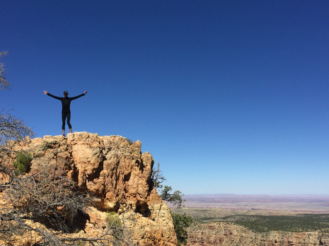
Zacher’s choice: The Grand Canyon. “You go down before you go up,” she says. But, as she tells clients, the journey will be worthwhile if you don’t give up.
Details: There are multiple day-hike options on both the South Rim and North Rim. From the south, the Rim Trail is the easiest, the Grandview Trail the steepest and most difficult. As the park’s website notes, every year, 250 hikers have to be rescued (not the same hikers, of course). “The difference between a great adventure in Grand Canyon and a trip to the hospital (or worse) is up to you,” cautions the National Park Service website. “Do not attempt to hike from the rim to the river and back in one day.” Remember: It’s a long way down … and a long way back.
Location: 20 S. Entrance Rd., Grand Canyon Village, 86023
Lookout (for the Unexpected) Mountain
Life is nothing if not unpredictable. Which hike best represents the unexpected nature of the coming year?
Zacher’s choice: The Seven Falls Trail in Tucson’s Sabino Canyon. “I always tell people that when changes come into our life, you have two ways to live,” she says. “You can embrace it and look forward to it, or you can resist it. Just like on a hike, you know you have to keep going or you’ll get stuck. Embrace the unexpected.”
Details: This 7.8-mile trail in Northeast Tucson crosses Bear Creek seven times. After a series of switchbacks comes an uphill climb leading to the payoff, a stunning view of waterfalls.
Location: 5900 N. Sabino Canyon Rd., Tucson, 85750
2016 Viewing Area
With time racing by, the month of January is perfect to pause and reflect on what happened in the last year. What’s the best place to visualize the near-past?
Zacher’s choice: Alta Trail. “You have to reflect on the things that worked and didn’t work to be able to improve,” she says. “I coach kids, and they’ll have a race that sometimes is great and sometimes doesn’t come out well. So I’ll say, ‘Let’s sit and think about it.’ Or in my own races, I try to look for the things that worked and didn’t work in order to move forward.” Alta Trail is the perfect place to ponder.
Details: This is a steep climb through South Mountain Park. The Alta Trail is a 9-mile round trip that is too challenging for beginners, which makes it enticing for experienced hikers who like solitude. Those who complete the steep hike to the ridgeline are afforded a view of the world at their feet, and the past in the rearview mirror.
Location: 10919 S. Central Ave., Phoenix, 85042
New Year March
Away with 2016, time to begin again. Which trail best symbolizes a fresh start?
Zacher’s choice: Piestewa Peak Summit. “I love Piestewa Peak — it’s the first one I hiked when I moved here from Mexico,” she says. Formerly known as Squaw Peak, Piestewa represents the new climb we are about to begin: “You can always start anew. We love dates, and the New Year brings the opportunity to start fresh and think about goals you want to achieve. It’s a great time cosmically to make wishes.”
Details: While there are various trails, the main one is a 2.4-mile trail leading to a 2,608-foot peak (named after Lori Piestewa, who died in Iraq). Often crowded, the trail begins deceptively easy, with an increasingly steep challenge.
Location: 2701 E. Squaw Peak Ln., Phoenix, 85016
MODERATE
Black Mountain Trail
Moderate – 2.3 miles
Year-round
Black Mountain Summit Park – Cave Creek
Tom’s Thumb Trail North Side Loop Trail
Moderate – 3.9 miles
March to October
McDowell Mountain Regional Park
Pinnacle Peak Trail
Moderate – 3.9 miles
March to October
Pinnacle Peak Park – Scottsdale
Spear S. Ranch Trailhead to Cave Creek Regional Park
Moderate – 4 miles
Year-round
The Maricopa Trail
Apache Wash Trail
Moderate – 4 miles
September to March
Phoenix
EASY
Lost Dog Wash Trail
Easy – 4.5 miles
Year-round
McDowell Mountain Regional Park
Dixie Mountain Loop Trail
Easy – 4.7 miles
Year-round
Phoenix Sonoran Desert Preserve
Flatlander
Easy – 1.25 miles
Year-round
Thunderbird Conservation Park – Glendale
Sears Kay Ruins Trail
Easy – 1.6 miles
Year-round
Tonto National Forest
ADVANCED
Table Mesa Trail
Moderate – 4.3 miles
Year-round
New River
Sunrise Mountain Trail
Moderate – 4.3 miles
March to October
Hillcrest Park – Peoria
Union Peak Loop
Moderate – 5.8 miles
October to April
Phoenix Sonoran Desert Preserve
Deem Hills
Circumference Trail
Moderate – 5.9 miles
February to November
Deem Hills Recreation Area
HARD
Cholla Trail
Hard – 2.6 miles
September to May
Echo Canyon Park – Scottsdale
Gateway and Tom’s Thumb
Loop Trail
Hard – 9.9 miles
October to April
McDowell Mountain Regional Park
Cave Creek Trail and
Skunk Creek Trail
Hard – 10 miles
Year-round
Tonto National Forest
Sunflower Mine 4×4 Trail
Hard – 28.7 miles
March to October
Tonto National Forest