
Frozen Frontiers
Arizona’s Hidden High Country
Writer Joseph J. Airdo
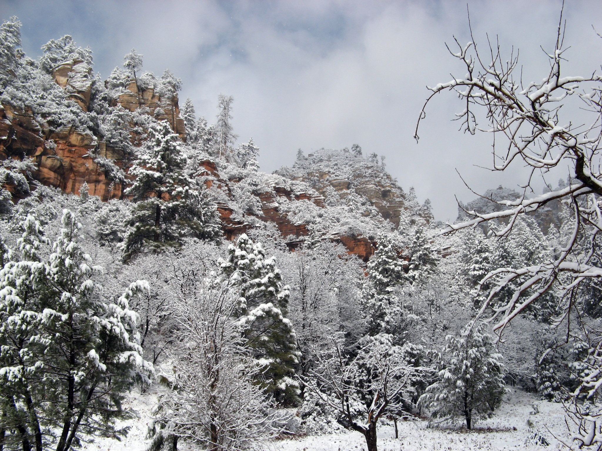
The first heavy snow changes everything. Gates swing shut across forest roads. Plowed pavement gives way to unmarked white. The crowds that mobbed these lakes and trails all summer vanish, leaving the high country to those who understand that Arizona’s most compelling landscapes emerge only when wrapped in winter silence.
Between December and early April, when road closures turn casual destinations into earned expeditions, Arizona’s mountains reveal a different character entirely. This isn’t the Arizona of resort brochures or commercial ski hills. These are places where preparation matters, where solitude becomes the reward, and where the landscape — simplified to snow, trees and occasional wolf tracks — offers something increasingly rare: the chance to be genuinely alone in transformed wilderness.
Alpine Heart
Hannagan Meadow sits at 9,100 feet along Highway 191, serving as the spiritual center of the White Mountains. The historic lodge provides warmth and lodging, but the real attraction sprawls beyond — vast meadows rimmed by dense spruce-fir forests, Nordic ski trails disappearing into the timber, and elk emerging at dawn from the tree line. Families return here season after season, generation after generation, to the same sledding hills and snowshoe trails their parents and grandparents knew.
Just west lies Williams Valley Winter Recreation Area, where old-school sledding happens without commercialization. No groomed runs, no ticket windows, no infrastructure — just a beloved community hill and the instruction to bring your own sled. The nearby Rails-to-Trails rest stop on Route 260 offers steeper terrain for serious sledders, while Toboggan Hill Trailhead near Greer continues the tradition with nothing more than a Forest Service parking lot and slopes worn smooth by decades of use.
But the White Mountains’ most evocative winter destinations require genuine effort. Crescent Lake, a 100-acre alpine gem at 9,000 feet, sits just 2 miles north of Big Lake yet becomes completely vehicle-inaccessible from December through early April. The snowshoe approach — the only approach — rewards with a frozen mirror reflecting subalpine forest and the satisfaction of reaching a place most will never see in winter. Winter fish kills necessitate spring restocking, making this a truly seasonal destination that exists fully only when buried under snow.
Pole Knoll Recreation Area near Greer spreads 18 miles of interconnected trails through terrain at 9,000 feet. Originally designed in the 1980s by a U.S. Forest Service employee seeking somewhere to ski after work, these routes carry evocative names: Red Tail, Osprey, Raven, Meadowlark. The Summit Trail climbs 800 feet to White Mountains views, while gentler loops wind through ponderosa and aspen groves. Unlike commercial operations, Pole Knoll remains beautifully undeveloped — trails, snow, silence.
For wilderness seekers, Escudilla Mountain shelters Arizona’s third-highest peak at 10,916 feet in the far eastern mountains. Winter transforms the 6.6-mile round trip into genuine mountaineering, gaining 1,600 feet through territory that shelters Mexican wolves, elk and black bears. Recent trip reports note total solitude — entire days without encountering another human.
Mount Baldy Wilderness, while its 11,421-foot summit remains off-limits on Apache land, offers the East and West Baldy loop exploring the Little Colorado River’s headwaters through subalpine forest. Winter transforms this 16-mile journey into an expedition through ancient Douglas firs where you’ll likely be the only hikers for miles.
The Blue Range Primitive Area — the only such designation remaining in the National Forest System that hasn’t been reclassified as wilderness — offers 173,762 acres of rolling ponderosa hills and deep canyons along Arizona’s eastern border. Winter visitors find wolf tracks, ecological diversity despite 2011 Wallow Fire impacts and profound isolation.
North of the Noise
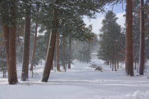
While Snowbowl draws weekend crowds, Flagstaff’s winter magic happens elsewhere. Arizona Nordic Village offers more than 40 kilometers (24 miles) of groomed trails and 15-plus miles of marked snowshoe routes through ponderosa pines northwest of the city. What distinguishes this sanctuary isn’t just the trail system but the remote yurts and cabins scattered across acres of forest. Weekdays feel nearly private — watching snow sift through trees, hearing only the swish of skis and Steller’s jays overhead.
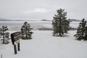
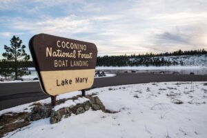
Lake Mary, just southeast of Flagstaff, transforms completely under winter conditions. While Lower Lake Mary often lies dry, Upper Lake Mary sometimes freezes solid enough to invite ice anglers and lakeside wanderers. Locals flock here for sunrise walks along wind-scoured dikes, watching for elk herds in meadows beyond. When access roads close, the basin becomes stark, beautiful and visited only by those seeking genuine off-season peace.
Mormon Lake reaches peak magic after deep snowfall. When conditions allow, local enthusiasts groom a network of cross-country trails weaving through meadows and old-growth pines. The Mormon Lake Ski Touring Center provides a low-key hub far from commercial operations. On bluebird mornings, the frozen lake glows against snow-dusted ponderosas.
Hart Prairie Road and the trail to Bismarck Lake offer less-traveled routes on the San Francisco Peaks’ western flanks. Forest Road 151 winds through ponderosa and aspen glades with Hochderffer Hills to the west and the peaks looming between branches. When winter closes roads to vehicles, snowshoers and skiers discover this meadow-studded landscape transformed, following the 1.5-mile trail to Bismarck Lake where elk, deer and raptors gather.
Lockett Meadow and Inner Basin Trail, famous for fall aspens, become winter destinations when snow closes Forest Road 552. Winter buries the meadow and Inner Basin under deep snow, creating opportunities for backcountry skiing and snowshoeing to 9,792 feet. The narrow road that intimidates summer visitors becomes impassable, turning this into a trek-in destination where elk herds emerge at dusk.
For serious backcountry enthusiasts, Kendrick Peak Wilderness harbors the 10,418-foot highpoint of Kaibab National Forest. The 9-mile round trip gains 3,000 feet through fire-scarred ponderosa transitioning to higher elevations. Winter transforms this into a serious undertaking, with snow accumulations past 9,400 feet and ice-covered upper sections requiring microspikes. Isolation increases dramatically in winter — you might encounter only a ranger with a dog.
Kachina Peaks Wilderness along the south face of the San Francisco Peaks offers the 5-mile Kachina Trail through old-growth forest at 8,800 to 9,500 feet. The trail crosses dramatic lava cliffs from 600,000-year-old eruptions and winds through ancient Douglas fir, limber pine and fern meadows. Winter snow accumulations make this genuine backcountry territory, far from Snowbowl’s crowds.
The Rim’s Hidden Edge
The Rim Lakes area — Woods Canyon and Bear Canyon — sees road closures that create both challenges and opportunities. Woods Canyon sits atop the rim surrounded by ponderosa pine, Douglas fir and oak, its 52-acre surface freezing over in harsh winters. Those willing to approach on snowshoes or cross-country skis find solitude in terrain mobbed during summer.
Willow Springs Lake near Payson becomes an ice fishing destination known primarily to locals in the region. The 158-acre lake, with an average depth of 60 feet, freezes solid from December through March. It is inaccessible by vehicle but perfect for adventurous ice anglers. Summer crowds disappear entirely as winter transforms the lake into a windswept sheet of ice where only the most dedicated anglers venture.
Christopher Creek area along the Mogollon Rim receives reliable snowfall averaging 15 inches annually, with February typically bringing 4.6 inches. The See Spring Trail follows Christopher Creek to cascading springs at the rim’s base, becoming a winter landscape of iced-over cascades and snow-laden pines. Summer camping territory transforms into a quiet winter retreat accessible from Payson.
Southern Sanctuaries
Arizona’s sky islands receive surprising snowfall, creating alpine environments in unexpected places. Mount Graham in the Pinaleño Mountains near Safford stands as the state’s most prominent peak at 10,720 feet. Winter road closures from Oct. 15 through April 15 force hikers to start from Shannon Campground at 9,170 feet, creating a genuine winter ascent. Swift Trail becomes a snow-covered service road through pick-up-sticks forests, with summit temperatures cold and winds howling across this isolated sky island.
Rose Canyon Lake, at 7,000 feet on Mount Lemmon, closes its gates from mid-October to mid-April. Determined anglers and hikers walk the mile-long paved road down to this 6-acre alpine lake surrounded by ponderosa pines. The transformation from summer crowds to winter silence is complete — serene lake views, snow-dusted pines and mountain solitude unexpected just 30 miles from Tucson.
Earning Winter
These destinations share requirements: preparation, respect and a genuine appetite for solitude. Summer’s casual accessibility vanishes behind snow gates and road closures. Crowds evaporate. The landscape simplifies — snow, trees, silence, occasional wildlife tracks.
Pack layers. Carry emergency gear. Check road conditions. Remember that cell service disappears in these sanctuaries. But for those willing to earn their winter experience, Arizona’s hidden high country offers something increasingly rare — the chance to encounter true solitude in landscapes transformed by snow into something approaching the sacred.